
Hey, friend – welcome back to another post! Today, I wanted to share some pictures and transcriptions of the historical markers I found in Kingfisher, Oklahoma. I’ve included addresses with each marker in case you want to go find them yourself. Let’s get started!
Historical Society Birthplace
“Oklahoma Historical Society was organized May 27, 1893, by the Oklahoma Press Association, in convention at Kingfisher. The Society headquarters were established in the first courthouse at Sixth and Admire, and remained in this city until 1895.”

Address: 101 South Main Street (This marker is at the Kingfisher courthouse. The next marker in this post is across the street!)
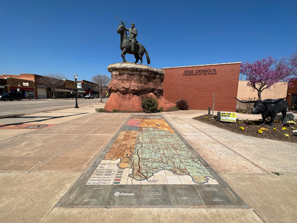
Jesse Chisholm “Ambassador of the Plains”
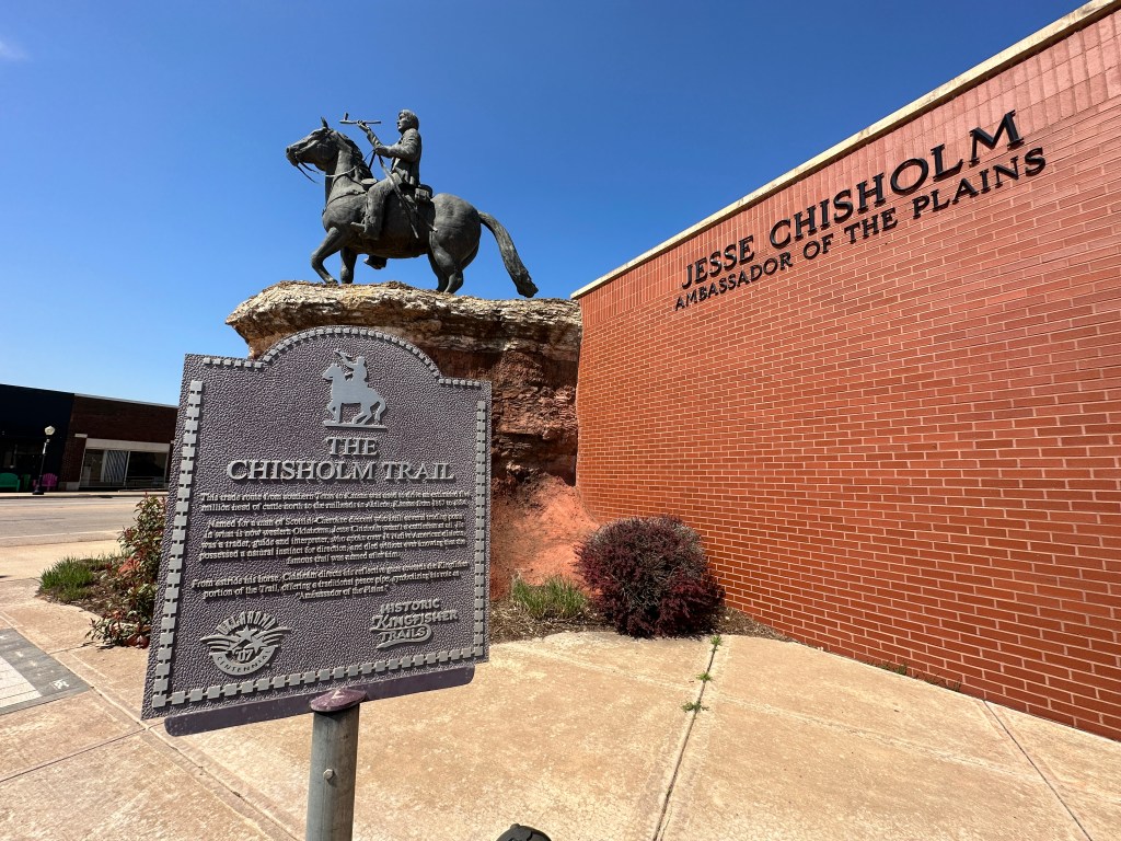

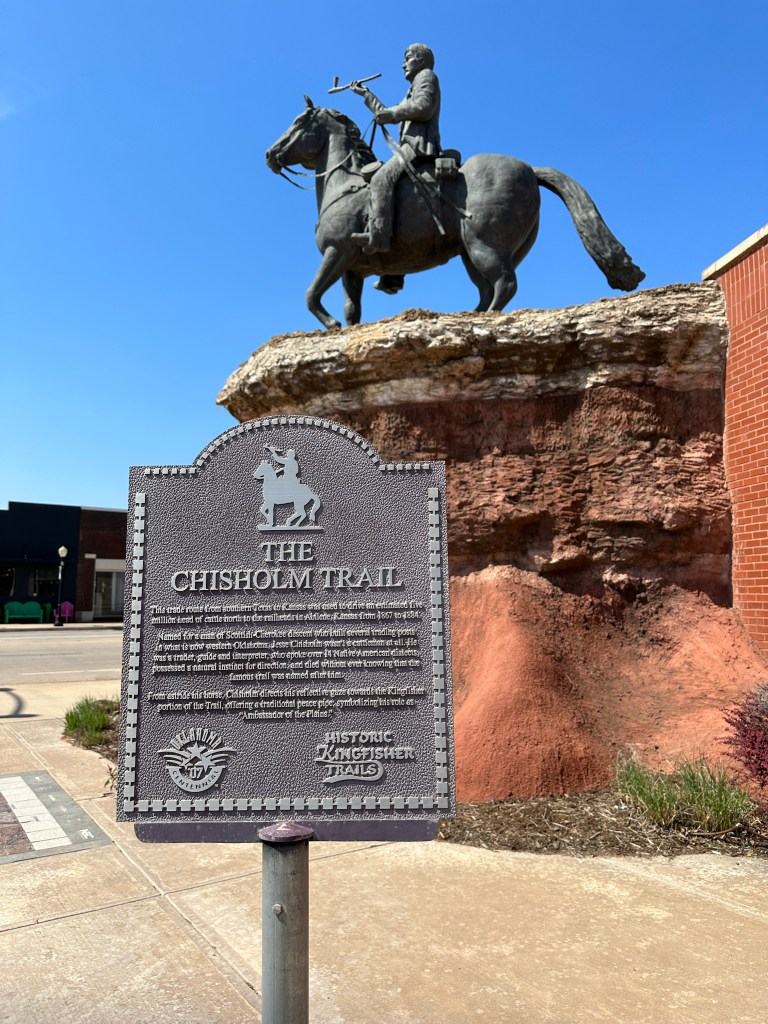
“This trade route from Southern Texas to Kansas was used to drive an estimated five million head of cattle north to the railheads in Abilene, Kansas from 1867 to 1884.
Named for a man of Scottish-Cherokee descent who built several trading posts in what is now western Oklahoma, Jesse Chisholm wasn’t a cattleman at all. He was a trader, guide and interpreter, who spoke over 14 Native American dialects, possessed a natural instinct for direction, and died without ever knowing that the famous trail was named after him.
From astride his horse, Chisholm directs his reflective gaze towards the Kingfisher portion of the Trail, offering a traditional peace pipe, symbolizing his role as “Ambassador of the Plains.”


Lame Bull Of the Cheyenne


The text from this historical marker was written by Lame Bull’s great great grandson, Greg SpottedBird (Lamebull). The sculpture was commissioned by Robert “Bobby Joe” Lamebull.
“Lame Bull is honored here as a prominent medicine man, artist, and leader within the Cheyenne. He was born in 1833 to Shaking Crane and Yellow Horse Woman and lived most of his life with the Cheyenne and So’taeo’o Tribes in what is now the states of Montana and South Dakota.
Despite his disability, Lame Bull became a prominent Dog Soldier War Society Member and fought in several battles including the Battle of Little Bighorn in Southern Montana.
Lame Bull was married to Bull Behind Woman and settled in the geographical location of what is now Downtown Oklahoma City around 1890. As Oklahoma approached its statehood and the Land Run drew near, many bands were, once again, removed from their settlements and Lame Bull moved his camp to what is now Western Kingfisher County where the Lame Bull allotment remains.
Lame Bull passed away on February 20, 1901 followed by his wife Bull Behind Woman in 1908 and are both buried on the allotment.
Today the Lamebull name still lives on with several great-grandchildren, some whom were born and raised on the historic family grounds.
Lame Bull’s teachings, art, and stories remain still, being passed down through the generations.
Several of his personal artifacts, either traded or gifted are displayed in museums across the country including History Colorado in Denver and The Smithsonian National Museum of the American Indian in Washington, D.C. The rest remain in the Lamebull homes.”
Address: 105 N Main Street
Kingfisher Stage Station
“This stage station on the old Chisholm Trail, 1867-1889, was 4 blocks no., on south side of Kingfisher Creek. The trail had two branches in this area; one for cattle was 6 miles east.”

Address: 45th Infantry Division Park (There’s a gas station across the street where I parked and then walked over to the park. The marker faces the gas station.)
Bicentennial Marker


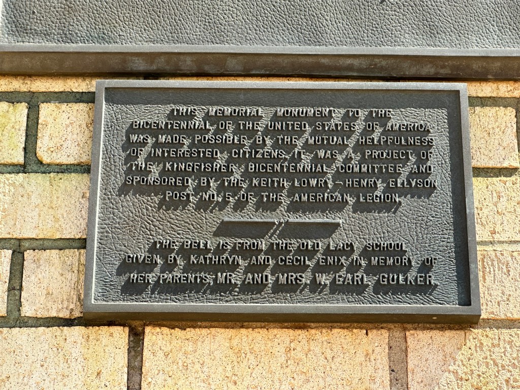
Sculpture by Tasso Pitsiri.
The left panels read as follows:
Kingfisher County
1776 Bicentennial 1976
Memorial Monument
Dedicated to all generations: “A past to remember, a future to mold, and God to glorify.”
Memorializing: Those who gave their lives for our freedom.
The Farmer – He feeds the world.
The Bell – Proclaiming freedom throughout the land.
(Leviticus XXV:10)
The right panel reads as follows:
“This memorial monument to the bicentennial of the United States of America was made possible by the mutual helpfulness of interested citizens. It was a project of the Kingfisher Bicentennial Committee and sponsored by the Kieth Lowry-Henry Ellyson Post No. 5 of the American Legion.
The bell is from the old Lacy school given by Kathryn and Cecil Enix in memory of her parents, Mr. and Mrs. W. Earl Gulker.”
Address: Next to the Kingfisher Courthouse.
Land Run of ’89 and ’92 Markers


Run of ’89 West Boundary
“On this line – – 98 degrees W. longitude – – many campers sat by their fires the night before the opening of Old Oklahoma. The next day at noon on April 22, 1889, many people set out running on foot and by horse for 160 acre land claims in Unassigned Land east.”
Run of ’92
“East boundary of Indian Country – – 98 degrees W. longitude west of this line lay the land of the Cheyenne and Arapaho. Each member of their two tribes had been allotted 160 acres before the surplus land was opened to settlers at noon on April 19, 1892. They ran west from this line for homesteads. Gov. A.J. Seay of Oklahoma Ty. was living at Kingfisher. His grave is near.”
Address: Located on State Highway 33 across the street from the Kingfisher cemetery.


“This was the U.S. Land Office site for filing claims at opening of “Old Oklahoma,” April 22, 1889; also, at opening of Cheyenne and Arapaho lands on April 19, 1892. J.C. Roberts was first Register, and J.V. Admire, first Receiver. First postoffice, Lisbon, established April 20, 1889; name changed to Kingfisher, July 18, 1889.”
Concluding Thoughts
I hope you enjoyed seeing some of the historical markers in Kingfisher, Oklahoma. There are a few more that I didn’t get to about the Land Run, so I’ll update this post once I go back and grab pictures of those three markers.
Happy Traveling! I’ll talk to ya soon 🙂

Leave a comment