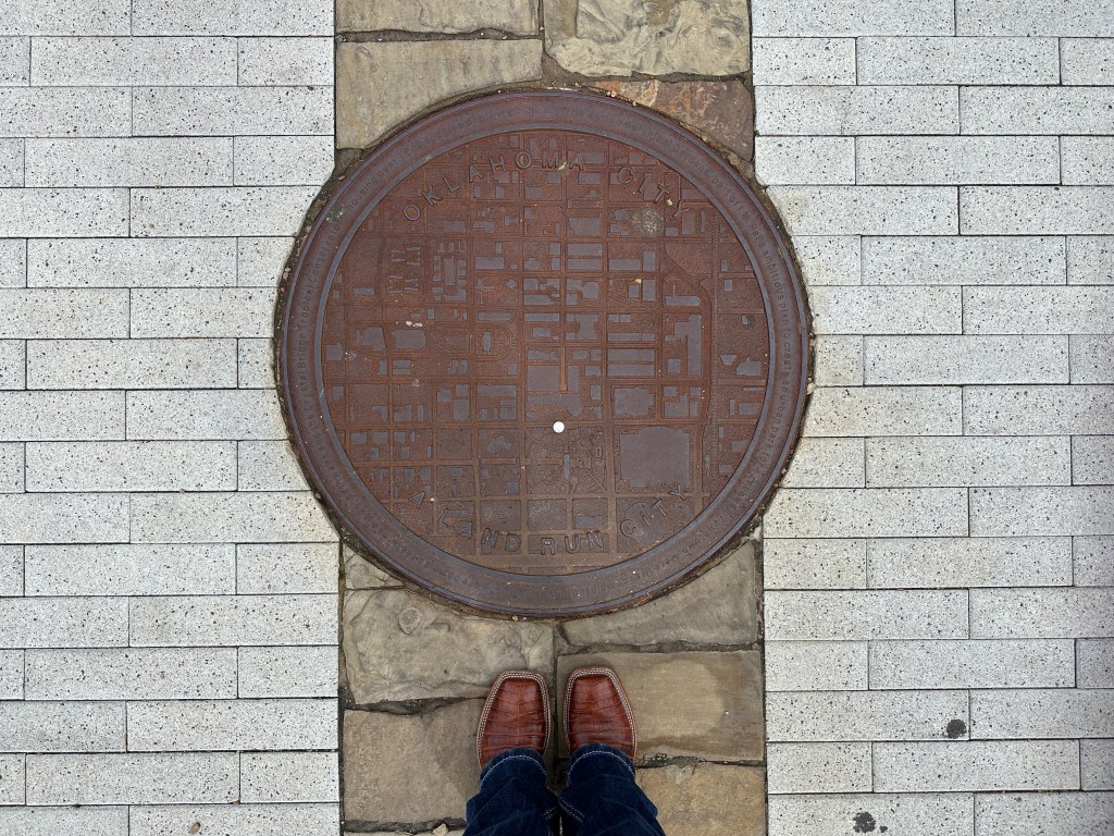
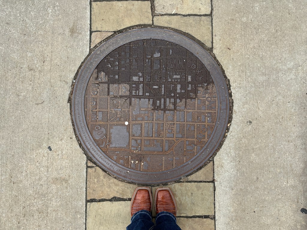
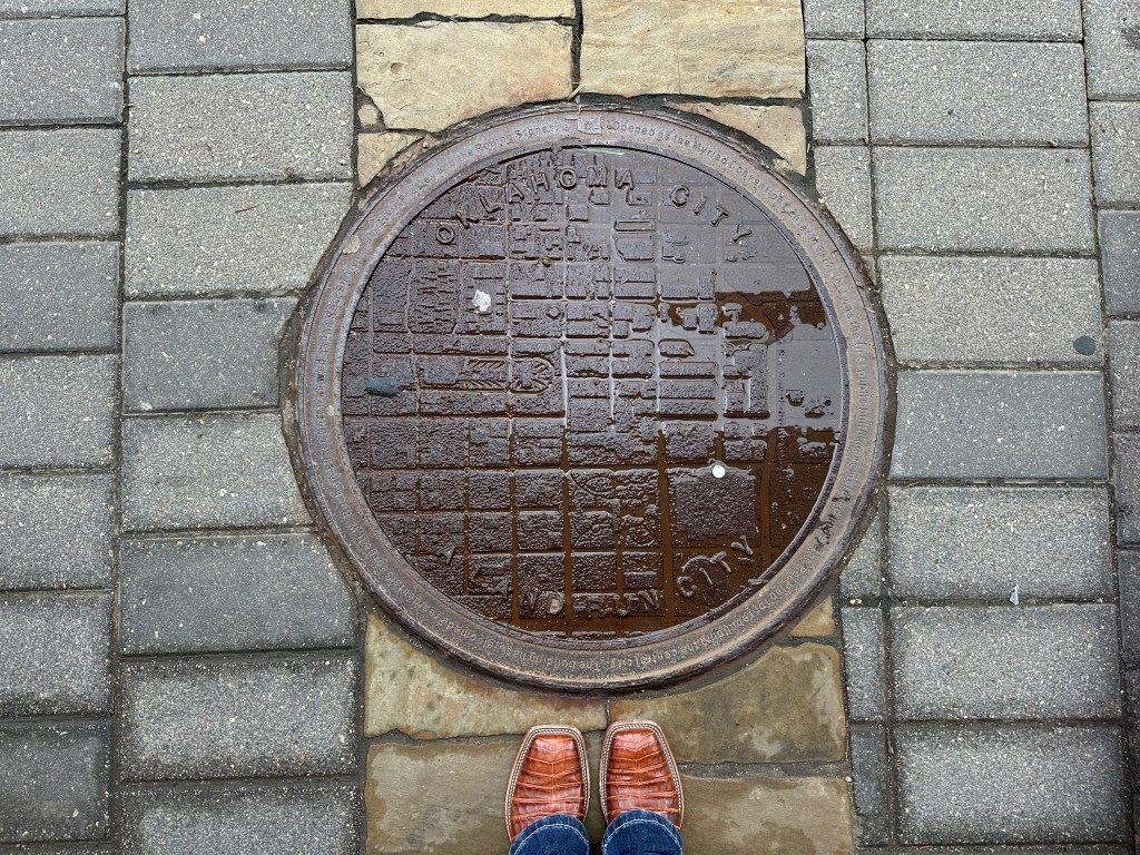
Hey, friend! Welcome back to another post. Today, I wanted to show you some of these cool maps on the manhole covers throughout Oklahoma City. Each cover has a fun fact about Oklahoma history around the edge so of course we’re going to talk about them. I’ll update this post as I continue finding more of the maps.
Let’s get started!
“The Myriad Botanical Gardens – part of I.M. Pet’s ambitious plan to create an urban park for a renewed downtown, were first completed in 1988. The 17-acre complex features a lake, pathways and the Crystal Bridge Tropical Conservatory housing over 1,000 species of plants.”
Location: In front of Vast/North side of Myriad Gardens on Sheridan.
“Red Earth Festival, a major Native American cultural and arts exposition was founded in 1987. The opening parade has filled streets with participants in full regalia. More than 1,200 Native American artists, dancers and singers from over 100 tribes have gathered each June for the festival.”
Location: On Robinson and Sheridan between Flint Kitchen & Bar, Mahogany Prime Steakhouse, and the Myriad Gardens.
“Opened as the Myriad Convention Center in 1972, this was the first public building completed under the Pet Plan for rebuilding the central city. The building has welcomed Presidents George H.W. Bush and Bill Clinton as well as the Rev. Billy Graham, Elvis Presley and The Rolling Stones.”
Location: Corner of Sheridan and Broadway.

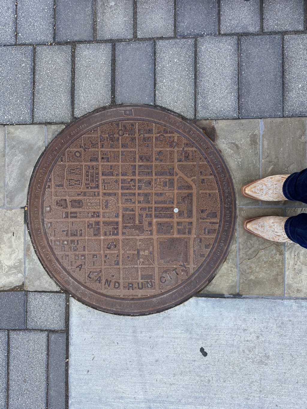
“1968 was a Renaissance year for Oklahoma City with the construction of major downtown buildings including a new home for Liberty Bank (1918-1997). At 36 stories, this was the city’s tallest building for four decades.”
Location: Near the Bancfirst Tower on Broadway and Park Avenue.
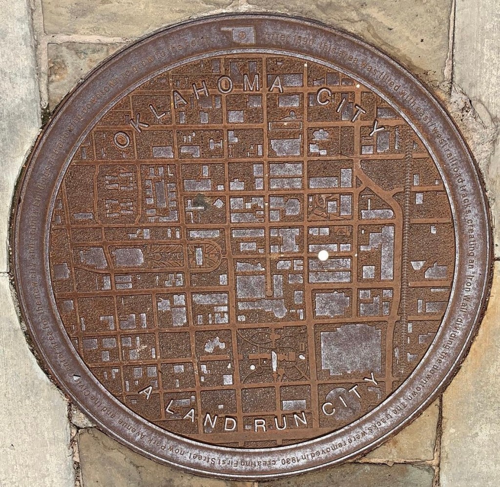
“After 1890, this area was filled with east / west railroad tracks, creating an “Iron Wall” dividing the downtown. The tracks were removed in 1930, creating First Street, now Park Avenue and the Civic Center area for the new city and county buildings and allowing downtown to grow to the north.”
Location: On Park Avenue near King Ranch Saddle Shop.
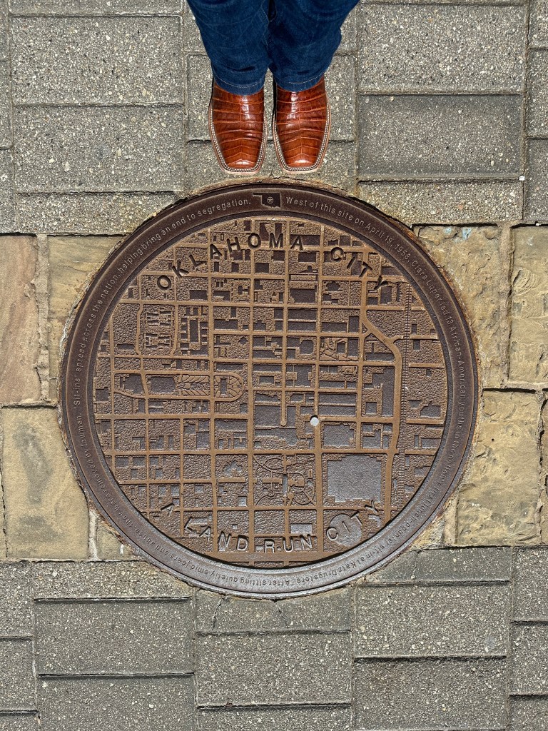
“West of this site on April 19, 1958, Clara Luper led 13 African-American youths in the nation’s first lunch counter sit-in at Katz Drugstore. After sitting quietly amid jeers and abuse, they were removed by lawmen. “Sit-ins” spread across the nation, helping bring an end to segregation.”
Location:

“Constructed in 1920 on the site of both the city’s first open-air theater and Lyric Theater, the Perrine / Cravens / Robinson Renaissance Building was once the home of the popular Anna Maude’s Cafeteria.”
Location:
“Oklahoma City’s Museum of Art opened 2002, utilizes the facade and theater of the 1947 Centre Theater in an expanded building housing three floors of galleries for exhibits and collections, including the works of Dale Chihuly whose glass sculptures are…. (can’t read – will update once I go back to the OKC MOA).”
Location: In front of the Oklahoma City Museum of Art.
“Old Post Office Building, it cost two cents to mail a letter when the east wing of the new Post Office was constructed in 1910. The west wing and central tower were added in the 1930’s. Its long rows of service windows attest to a period when everything was sent by mail.”
Location: Sidewalk in front of the Federal Judicial Learning Center & Museum.
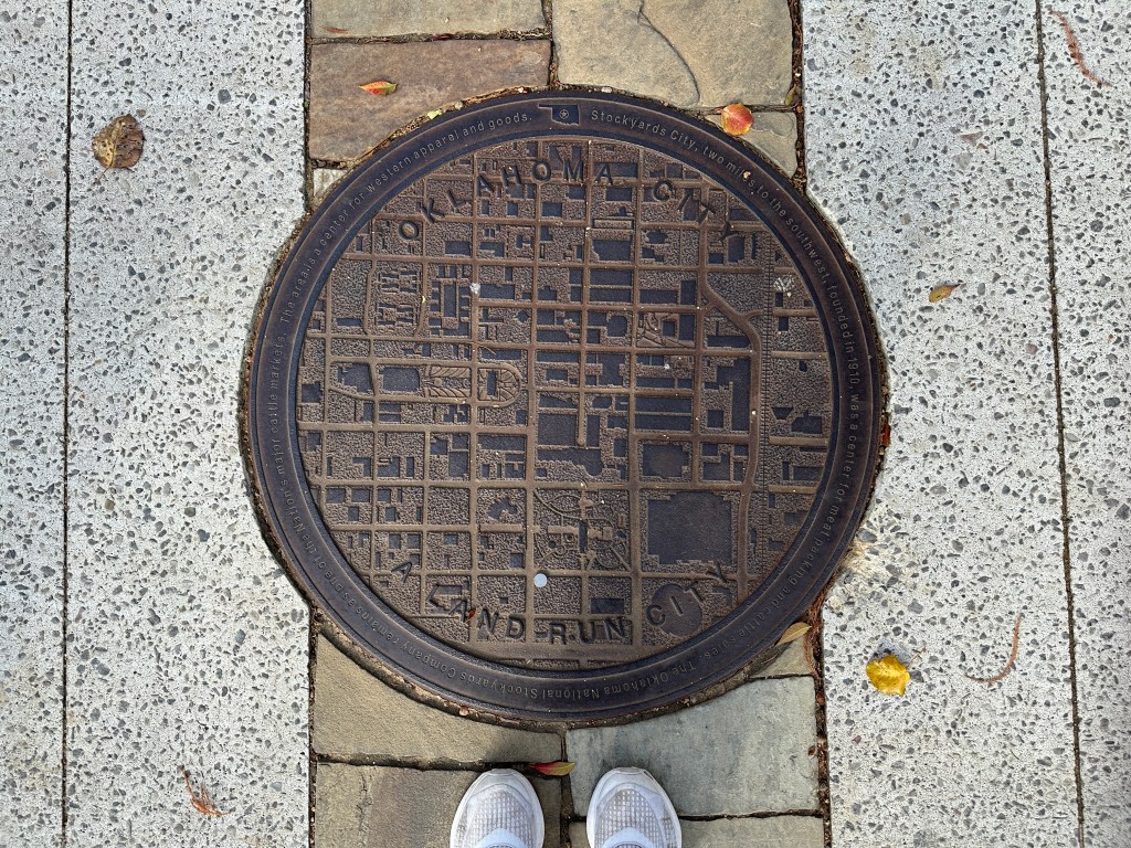
“Stockyards City, two miles to the southwest, founded in 1910, was center for meat packing and cattle sales. The Oklahoma National Stockyards Company remains as one of the Nation’s major cattle markets. The area is a center for western apparel and goods.”
Location: Southwest corner of the Myriad Gardens at Reno and S Hudson.

“Oklahoma, the Sooner State, “Boomer” and “Sooner” are terms from the Land Run of 1889. The Boomers were those who worked to open the Unassigned Lands of Oklahoma for settlement. The Sooners were those who entered illegally to stake claims before noon on April 22, 1889.”
Location: On Reno between the Paycom Center and the Courtyard Hotel.
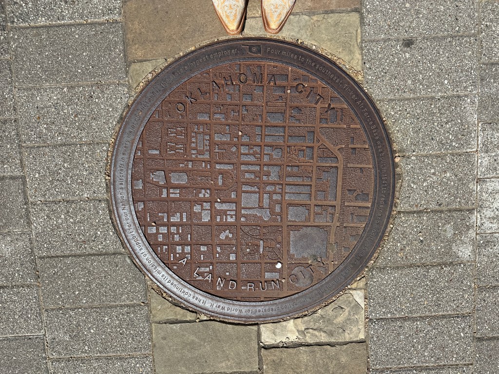
“Four miles to the southeast, Tinker Air Force Base was built in 1941 to repair and modify bombers and cargo planes as the nation prepared for World War II. It has continued its mission of support for our Nation’s aircraft in every major conflict and is the state’s largest employer.”
Location:
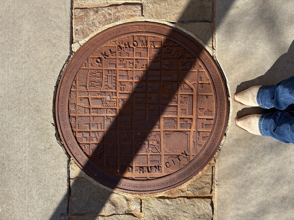
“Couch Drive honors William L. Couch, a leader in the Boomer Movement to open the Unassigned Lands to settlement and first provisional mayor of Oklahoma City, elected April 26, 1889. Couch was shot by a disgruntled land claimant and died of his wounds in April 1890.”
Location: In the sidewalk along the North side of Couch Drive. It is between the Civic Center and City Hall.

Leave a comment